Dreaming of stepping from your lanai onto your boat, then cruising straight to the Gulf? In Aqualane Shores, small details decide how smoothly that lifestyle works day to day. If you are comparing canal and bayfront homes here, the right questions can save you time, money, and stress. This guide shows you what to verify, why it matters, and which documents to request before you write an offer. Let’s dive in.
Confirm true Gulf access
Know your route to open water
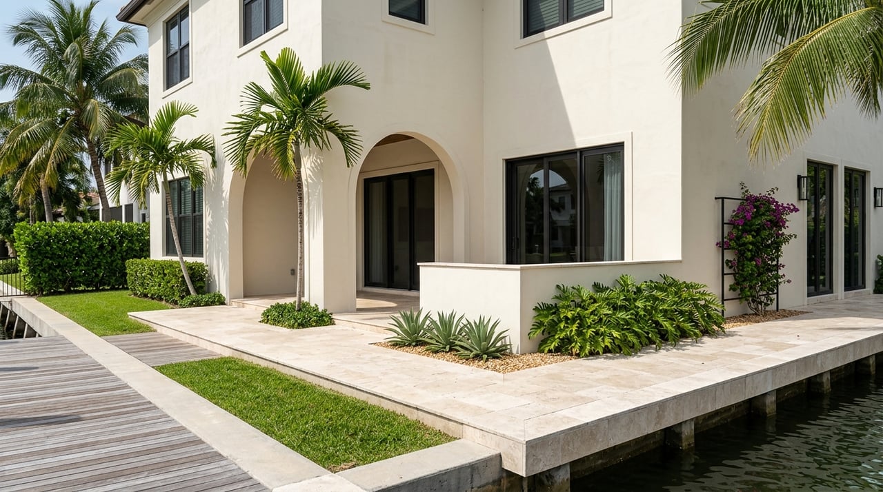
Aqualane Shores sits at the south edge of Old Naples with private, single-family lots tied into Naples Bay and the Gulf of Mexico. Many listings highlight direct Gulf access and private docks, but routes vary by street and canal. Ground your search in facts by confirming the exact path from the subject dock to the pass, including any slow zones and typical depths. A neighborhood overview helps frame the boating lifestyle, but you still need property-level details for your vessel size and draft. For background on the area’s waterfront character, see this Aqualane Shores neighborhood snapshot.
Measure depth and turning room
Depth at your dock and along your exit path is decisive. Use local NOAA chart coverage for Naples Bay as a starting point, such as NOAA Chart 11429, to understand channels and typical soundings. Charts are not a substitute for a recent sounding at your slip. Ask for a marine survey or property survey with depth readings at mean lower low water, plus measured canal width and turning basin dimensions. Storms can change bottoms, so rely on current data rather than neighborhood lore.
Check for bridge or overhead limits
Listings often advertise “no-bridge” access in Aqualane Shores, which usually means routes do not include low fixed bridges that cap air draft. Even so, confirm for your lot and route. Look for any fixed structures or overhead utilities that could limit height or beam. A general overview of Aqualane Shores’ boat-friendly setup is helpful, but personal verification avoids surprises. You can preview the neighborhood’s typical access advantages in this community profile.
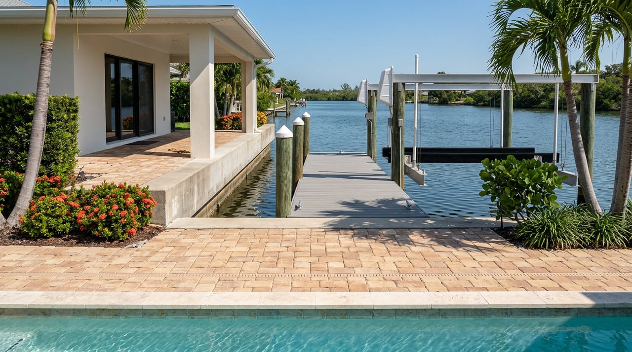
Evaluate docks and lifts
Document the lift
A great view does not guarantee a great lift. Collect the rated lift capacity, cradle width, beam allowance, mounting type, canopy specs, and any service logs. Confirm permits, final inspections, and any warranty transfers through Collier County’s marine permit process. For submittal requirements and what a complete file should include, review Collier County’s marine (PRMAR) guidance. If the system seems undersized or overloaded for the seller’s current boat, budget for upgrades.
Inspect the dock
Ask for the dock’s face length, pile type and spacing, and decking material. Note electrical pedestals, water, and lighting. Look for wear at fender boards, loosened cleats, and any corrosion on hardware. If storms or heavy traffic are common nearby, ask about previous repairs and any insurance claims. A licensed marine surveyor can validate safe approach, depth at low tide, and maneuvering clearance for your hull.
Assess the seawall
Spot red flags
Your seawall protects the land, dock, and home. Watch for bowing or leaning panels, soil loss behind the wall, open joints, scouring at the toe, corroded tiebacks, and differential settlement in pavers near the cap. Maintenance responsibilities and best practices are addressed in county clean-boating resources. For local stewardship and compliance context, see Collier’s Clean Boating guidance. Seawall condition can affect lending, insurance, and near-term capital plans.
Plan for realistic costs
Seawall work in South Florida ranges widely based on access, method, soil conditions, and engineering requirements. Market summaries place common repair work in the low-hundreds to high-hundreds per linear foot, with full replacements higher. To gauge your true number, combine contractor quotes with the property’s permit file and any prior engineer reports. For an overview of cost drivers, review this summary of seawall repair costs and variables.
Understand permits and rules
Waterfront improvements touch several agencies. Start local, then confirm state and federal layers.
- Local: Collier County reviews marine permits for docks, lifts, seawalls, and demo. Submittals typically include sealed site plans, canal widths, offsets, and references to water lines. Check records and final inspections through Collier’s PRMAR portal.
- State: The Florida Department of Environmental Protection oversees Environmental Resource Permits and submerged-lands issues, especially for new seawalls, dredging, or work near seagrass or mangroves. Some small repairs may qualify for exemptions, depending on footprint and habitat. You can explore permitting context via the Florida DEP portal.
- Federal: The U.S. Army Corps of Engineers regulates work in navigable waters and dredge or fill activities. Many small residential projects proceed under general or programmatic permits, but verification can still be required. See the Corps’ Regulatory Program overview.
Habitat rules matter. Manatee zones, mangroves, and seagrass can affect dock length, materials like grated decking, and work windows. Ask for written approvals, verifications, and as-built drawings for all existing waterfront features.
Flood and insurance math
Know your elevation
Most of Aqualane Shores sits in flood-prone areas, and lenders often require flood insurance. Do not rely on neighborhood reputation. Confirm the property’s FEMA flood zone and Base Flood Elevation, then request an Elevation Certificate if available. Elevation relative to BFE can change premiums significantly. Start with the FEMA Flood Map Service Center.
Plan for resiliency
Collier County participates in FEMA’s Community Rating System and is advancing countywide resiliency planning and vulnerability assessments. Local policy updates and map changes can influence insurance costs and renovation expectations over time. Stay current with the county’s resiliency planning resources during due diligence.
Value drivers in Aqualane Shores
Not all waterfront is equal. These features often drive stronger pricing and faster resale.
- Positive drivers: genuine direct Gulf access, bayfront or seaward orientation, end-of-canal geometry with easier maneuvering, a large dock face, a permitted high-capacity lift, and a recently rebuilt, documented seawall. For a broad view of how Aqualane Shores markets its access advantages, see this community overview.
- Discounting factors: shallow draft at low tide, narrow canals that constrain turning, overhead utility conflicts, unpermitted or undersized lifts, seawalls needing near-term replacement, and low elevation relative to BFE that pushes insurance costs. Use the FEMA Map Service Center to verify flood data tied to premiums.
Your due-diligence checklist
Request these documents from the seller or listing agent:
- Collier County marine permit records and as-built drawings for any dock, lift, or seawall.
- A current property survey that shows bulkhead or water lines and dimensions.
- Elevation Certificate and FEMA FIRMette, if available.
- Recent seawall and dock inspection reports or contractor invoices detailing age, method, tiebacks, and toe protection.
- Boat-lift specifications, rated capacity, and service or inspection history.
- Title documents that speak to riparian rights, easements, or shared maintenance.
- Any neighborhood guidance related to docks, guest mooring, or cost sharing for dredging.
Line up the right experts:
- A licensed marine surveyor to confirm depth at mean lower low water, turning room, and safe operating draft for your hull.
- A coastal, structural, or geotechnical engineer if the seawall shows movement or has a repair history.
- A licensed surveyor to produce a new Elevation Certificate if needed for insurance or lending.
- A local permitting consultant or county planner to verify permit status and transferability.
Operational checks:
- Ask local marinas or captains about recent shoaling, dredging needs near the pass, and realistic transit times at posted slow speeds.
- Note manatee and no-wake zones that may affect routing and timing.
Before you make an offer, confirm depth at the dock at low tide, verify lift capacity and permitting, get the flood-zone and elevation data, and obtain written copies of any dock or seawall permits. Use NOAA chart coverage for Naples Bay to frame the route, then rely on current, property-level measurements.
Ready to compare properties with confidence?
The right home in Aqualane Shores should fit your boat, your insurance plan, and your long-term maintenance outlook. If you want an advisor who brings Michelin precision to every detail and a hospitality-first process from showings to close, connect with David Rashty to walk your options and assemble a clean, verifiable file. Schedule a private consultation.
FAQs
What does “no-bridge Gulf access” mean in Aqualane Shores?
- It typically indicates routes to the Gulf do not include low fixed bridges that limit air draft, but you should confirm your specific route and check for overhead utilities using community context and on-site verification.
How do I verify depth at my dock before buying?
- Ask for a recent marine or property survey showing depth at mean lower low water, review NOAA chart coverage for channels, and hire a marine surveyor to take fresh soundings.
Which permits do I need for a new lift or dock in Collier County?
- Start with Collier County’s marine permit process for plans and setbacks, then confirm if state Florida DEP or federal USACE authorizations apply based on scope and habitat.
What seawall warning signs should I look for?
- Bowing or leaning panels, soil loss, open joints, toe scouring, or corroded tiebacks are common red flags; Collier’s Clean Boating guidance offers local stewardship context.
How do flood zones affect insurance costs for Aqualane Shores homes?
- Lenders often require flood insurance in Special Flood Hazard Areas, and premiums depend on your Elevation Certificate and Base Flood Elevation, which you can check via the FEMA Map Service Center.
Are there habitat rules that can limit dock length or materials?
- Yes, protections for mangroves, seagrass, and manatees can require grated decking, shorten docks, set seasonal work windows, or restrict dredging; check permit files and confirm with county and state reviewers.